Typology, network features and damage response in worldwide urban road systems

Abstract
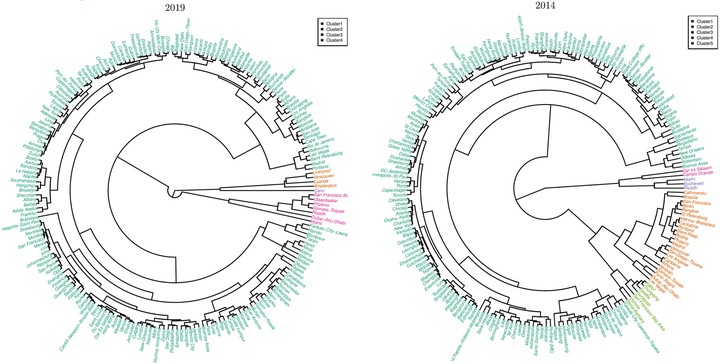
We survey the network properties and response to damage sustained of road networks of cities worldwide, using OpenStreetMap (OSM) data. We find that our primary damage response variable , which is the average shortest time needed to reach all nodes in a road network (which stand in for locations within a metropolitan area) from an initial node (which stands in for the location of a center for disaster relief operations), is strongly linearly–correlated with pd, the fraction of the road network segments damaged. We find that this result, previously reported for a city’s road network as opposed to grid and scale-free idealizations, is widely present across the road networks we have examined regardless of location. Furthermore, we identify three families of road networks according to their damage response, forming a typology by which we can classify city road networks. Using this typology, we identify the family of road networks which may be of most concern from a humanitarian standpoint. We also find that, of the properties of the road networks we examined, the average shortest path length, $